
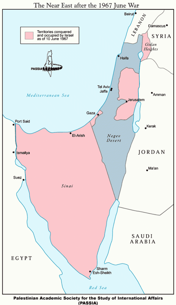
Above: The war of June 1967 began with a pre-emptive air strike by Israel in which it destroyed the air force fleets, while they were on the ground, of three neighboring nations, Jordan, Syria and Egypt. Without air capability these nations had little ability to defend their territories and this war ended quickly: it is known as the Six Day War. At the end of this war, Israeli forces had occupied all the areas in pink on this map: the West Bank, Gaza, the Golan Heights which belonged to Syria (at the northeast/upper right corner of Israel) and the Sinai Peninsula which belonged to Egypt (large area to the left/southwest of Israel).
The Camp David Accords, mediated by U.S. President Jimmy Carter, were fulfilled in 1982, at which time all of the Sinai Peninsula was again under Egyptian control.
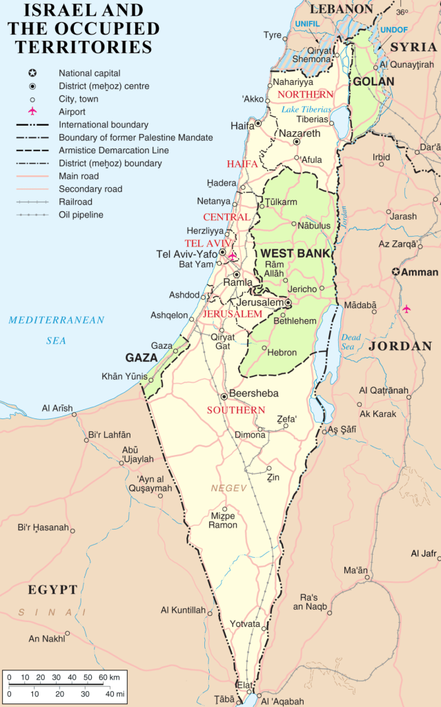
Above: This map shows in green the areas that Israel has had under military occupation since 1967. As noted in the previous map, the Sinai Peninsula was returned to Egyptian control by 1982.
In November 1967, the same year as the Six Day War, the UN Security Council unanimously adopted UN SC Resolution 242, which required the “withdrawal of Israeli armed forces from territories occupied in the recent conflict.” As of 2017, Israel has refused to comply with this UN Security Council resolution for fifty years.
https://www.palestineportal.org/learn-teach/israelpalestine-the-basics/maps/maps-1967-to-present/


You must be logged in to post a comment.